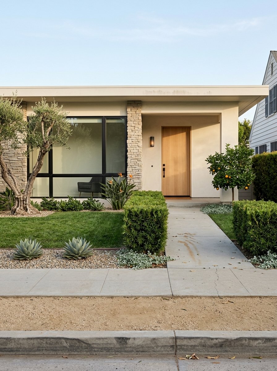
Want to rely less on your car without giving up suburban comfort? If you are eyeing Duarte, the area around the Duarte/City of Hope A Line station can make daily life simpler and more connected. You can plan errands on foot, grab the train for work or play, and keep a car for the occasional big run. In this guide, you will learn how to evaluate walkability by time, find homes inside a realistic walk‑shed, and plan a week that fits a car‑light lifestyle. Let’s dive in.
Why Duarte works car‑light
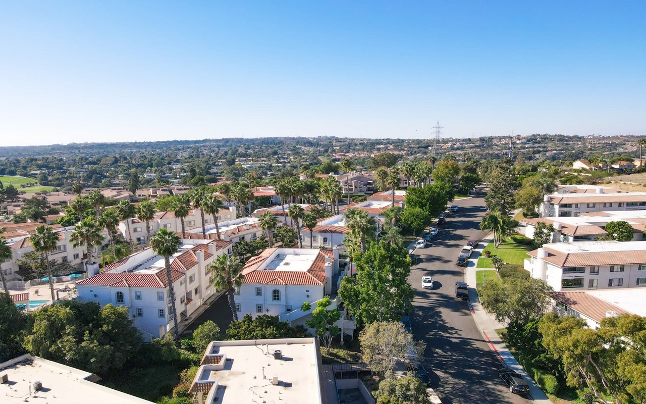
Duarte sits in the San Gabriel Valley with a mix of single‑family streets and pockets of denser housing near commercial corridors. The Duarte/City of Hope station on LA Metro’s A Line puts you close to rail service and a major employer and medical campus. This setup is helpful if you work at or visit City of Hope, or if you want easy rail access to regional job centers.
Before you set expectations, check current A Line service details. Look up peak and off‑peak frequencies, first and last trains for weekdays and weekends, and any planned construction that might affect your rides. Use Metro’s trip planner and real‑time tools to confirm connections to other rail and bus lines. Since schedules change, avoid assuming set travel times and verify before you tour homes.
Daily life by walk‑time
Use time, not distance, to judge convenience. A simple rule of thumb helps:
- 5 minutes is about 0.25 mile for daily essentials.
- 10 minutes is about 0.5 mile for most errands.
- 15 minutes is about 0.75–1.0 mile for bigger parks and weekly trips.
Actual times depend on street crossings, sidewalk quality, and topography. Always test the walk yourself.
Groceries and essentials
A full‑service supermarket within a 10‑minute walk is the single biggest driver of car‑light living. Smaller independent or specialty markets can cover produce and staples within a shorter walk. A nearby pharmacy or convenience store helps for last‑minute items. Delivery or curbside pickup can fill gaps when you cannot walk.
Parks and recreation
Pocket parks and playgrounds inside a 10‑minute walk make daily fresh‑air breaks easy. For weekends, look for larger regional parks or connected trail systems within a short ride on transit or a quick car trip. Multi‑use trails and bike routes that feed the station can also make first‑ and last‑mile trips smoother.
Healthcare and services
City of Hope sits next to the station and is a key destination for workers, patients, and visitors. Also check for walkable clinics, dental offices, banks, the post office, and other essential services. Confirm hours and locations with official city and institutional resources as you plan your routes.
Dining, coffee, and neighborhood life
A compact cluster of cafes and restaurants within about 10 minutes on foot adds flexibility to your routine. Pay attention to evening lighting, pedestrian traffic, and overall activity so you can decide if night walks feel comfortable to you.
Commuting and connections
The A Line links Duarte to nearby employment hubs and transfer points across the Metro network, including destinations like Pasadena and Downtown Los Angeles. For a realistic door‑to‑door estimate, plug your origin and destination into Metro’s trip planner and check real‑time arrivals on the day you plan to ride. If you will transfer, confirm the timing and frequency of connecting routes so you know how waits will affect your trips.
How to search inside a walk‑shed
Define “near” up front
Pick your radius first so every listing competes on the same terms:
- Very walkable: 5‑minute walk, about 0.25 mile.
- Comfortable walking: 10‑minute walk, about 0.5 mile.
- Broader access: 15‑minute walk, about 0.75–1.0 mile.
Many buyers use 0.5 mile as a practical standard for transit‑oriented living.
Use map tools that keep you honest
- MLS map search: Draw a polygon or radius centered on the Duarte/City of Hope station to capture only homes in your chosen walk‑shed.
- Google Maps: Use “Measure distance” to sketch quick circles, then inspect actual walking routes, crossings, and elevation changes.
- Walk Score and Transit Score: Check an address to gauge walkability and transit convenience as a first filter.
- Trip planning: Test commute targets with Metro’s planner or a real‑time app, then repeat during different times of day to see how reliability feels in practice.
- On‑the‑ground verification: Walk the route during a weekday rush, midday, and in the evening. Note lighting, traffic, sidewalk width, and where you wait at signals.
Prioritize property features that support car‑light living
- Housing type: Expect more condos and multi‑family near the station and more single‑family options a bit farther out.
- Parking: If you keep a car, confirm assigned parking vs. street, guest parking, and any permit rules.
- Storage and bikes: In‑unit or on‑site storage, secure bike parking, and package rooms reduce extra trips.
- HOA considerations: Review what fees cover, and any rules that affect how the building functions.
A quick walkability checklist
- Measure the walking route to the Duarte/City of Hope station, not just the straight‑line distance.
- Time the walk to a supermarket, pharmacy, bank, and a café.
- Check sidewalks, curb cuts, crosswalks, and pedestrian signals on your main routes.
- Observe nighttime lighting and foot traffic. Review publicly available safety data.
- Look for bike racks at the station and bike lanes that connect your home to the platform.
Tradeoffs to weigh before you buy
Noise and activity
Living close to a station often brings more foot traffic and some noise from light rail or nearby buses. Decide how much activity you welcome and whether window upgrades or interior layout can offset it.
Parking and car ownership
You can reduce car use in Duarte, but you may not eliminate it. Budget for occasional car trips and confirm on‑site parking if you own a vehicle. If your employer offers shuttles or bike‑commute amenities, factor those into your plan.
Housing types and pricing patterns
Homes closest to transit are often denser and may carry a convenience premium. Single‑family homes a little farther out can still be walkable, but you might drive for some errands. Review recent comparable sales around the station and talk with a local expert to understand how proximity affects price.
First‑ and last‑mile options
A property 0.5–1.0 mile from the station can still work well if you have safe bike routes, secure storage, and predictable train arrivals. Check for bike lanes, station bike parking, and the ease of crossing major streets.
Planning and future changes
Station areas often see new mixed‑use or higher‑density projects. Review city planning documents to understand potential changes to retail mix, parking, and construction timelines. Future development can add amenities, but it can also bring temporary noise.
A sample week without so many car trips
- Monday: Walk 10 minutes to the station, take the A Line to a transfer point for work, and pick up groceries at a nearby market on the way home.
- Tuesday: Lunch at a café within a short walk of home. Evening stroll to a pocket park.
- Wednesday: Medical appointment on or near the City of Hope campus, accessed by foot or a short bike ride via marked routes.
- Thursday: Remote work day. Walk to the pharmacy for household items and use delivery for bulky goods.
- Friday: Dinner at a neighborhood restaurant inside a 10‑minute walk. Check nighttime lighting and choose well‑lit routes.
- Weekend: Bike or take transit to a regional park for a longer outing. Use a car only for a bulk shopping run or a trip beyond the rail network.
Next steps
If living car‑light near the Duarte/City of Hope station is your goal, start with a clear walk‑shed radius, test your real commute times, and tour listings at different hours. A local team can help you draw smart search boundaries, compare recent sales near transit, and verify the daily details that make a home truly convenient.
Curious which Duarte streets give you the best blend of walkability, comfort, and value? Reach out to the Speranta Group’s local specialists to map a search that fits your routine and your budget. When you are ready, connect with us at Unknown Company to start your home search with a clear, car‑light plan.
FAQs
How close is close enough to the Duarte/City of Hope station?
- Many buyers target about a 10‑minute walk, roughly 0.5 mile, as a practical balance between convenience and housing options.
What errands can I do on foot within 10 minutes of the station?
- With one full‑service supermarket, a smaller market, a pharmacy, and a few cafés within 10 minutes, most day‑to‑day needs can be covered without a car.
Will I still need a car if I live near the station?
- Probably for some trips. You can cut many daily drives, but plan on occasional car use for bulk shopping and destinations off the rail network.
Are there grocery stores and parks within walking distance in Duarte?
- Many areas near the station offer a mix of markets, pocket parks, and trails within 10–15 minutes on foot or by bike; verify exact locations during tours.
Is walking to the station at night practical?
- It depends on lighting and activity along your route. Walk it after dark, note lighting and crossings, and choose the path that feels most comfortable to you.
Do homes near the station cost more than those farther away?
- Properties closest to transit can carry a convenience premium, especially condos or multi‑family, while single‑family homes slightly farther out may price differently.
How do I measure a listing’s walkability accurately?
- Time the actual walking route to the station and key errands, check sidewalk and crossing quality, review Walk Score and Transit Score, and test your commute in real time.
Are there planned projects that could change walkability near the station?
- Station areas often attract new development. Review City of Duarte planning documents for station‑area updates that may affect services, parking, and construction timing.